Pages

Showing posts with label Geocaching. Show all posts

Thursday, May 7, 2015

Portal Into the Past - Harrington, Washington History

Portal Into The Past

Hello everyone, 
 Today I bring you the third Portal Into the Past - Harrington, Washington History. Let me start off by saying that over the weekend we did not go Geocaching, so I decided to do this Portal Into the Past on Harrington, Washington, a small farm town in which I currently live. If you read on, I will give you something like the Ritzville History I gave last week - a post full of facts and interesting stories. I hope you enjoy this week's Portal Into the Past - Harrington, Washington History:

The green star is where Harrington is located
Since this weekend we did not go Geocaching, I decided to do a Portal Into the Past on Harrington, Washington, a small town I currently live in. Harrington is a great community of about 400 people. It is located in Lincoln County, Washington. Harrington's start was in 1882 when the firm of Harrington, Furth, and Robinson bought the land because they knew it was fertile and good for farming. Currently, Harrington is known for its wheat farming. The town was named after W.P Harrington who was a banker from Colusa, California and an investor in the Harrington land.

The town of Harrington soon had many buildings. Edward Willis and Charles Billings opened up the first store in Harrington. A year later, the post office was opened and Edward Willis became the first post master. Then in 1884, the blacksmith opened up followed by the Pickell Hotel. Then two years later in 1886, the saloon was opened.


In 1892, Harrington received its first grain bins that were from the Northern Railway Company which ran through the middle of town. Within two more years, Harrington's population grew as the railroad
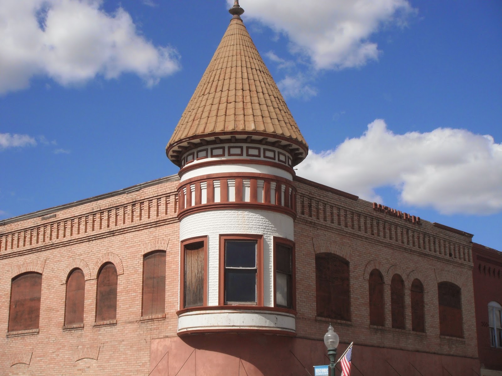
The old City Hall
expanded and improved. After that, Hotel Harrington opened and the main street was created. At this time, the town of Harrington had a two-room school house, drug store, stables, meat market, barber shop, two hotels, four general stores, the bank, and furniture stores. 

For five years, Harrington was in a depression. Prices for grain were extremely low. But finally in 1892, the depression ended and the Harrington Milling Company was created in the early 1900's. In 1901, A.C Billings was chosen as Harrington's first mayor. The city hall was built and Harrington reached their highest population of about 850 people. Soon, in 1901, the Portland Milling Company bought the mill. With that, C.D Ellis became manager and the mill increased its production rate to 325 barrels a day.

The Bank Block Building was created in 1904 which was home to the Bank of Harrington, Opera House, a barber shop, saloon, and lodging. Currently, this area is where the City offices and library are located and the Opera House is being restored to its former glory. In 1914, a new school was created to replace the two-room school house. Two years later, the telephone and telegraph came and Harrington created a camp for tourists.
The Opera House where city offices and library are located

But things started changing for the town of Harrington. In 1920, the prices of wheat dropped dramatically, the crops were failing, and a new depression was starting for the local farmers. Luckily, crops improved three years later in 1923, but the prices of wheat were still low. Because of this, Harrington's population size began shrinking. The Odessa Union Warehouse bought the Harrington Milling Company, later changing it into a bulk grain elevator. After the depression, the only bank that remained was the Harrington State Bank.

Then in 1923, Harrington had a horrible event - a fire that destroyed many things. The fire burnt down the harvester plant and then the hospital burned down just 10 years later. Sadly, neither of these buildings were rebuilt. Along with this, many other buildings were burnt to dust in the fire.

A water tower was built in 1938, costing $10,450. After World War II ended, the water tower was redone, but some original parts still remain. Then in 1949, a grade school was built to replace the old school. And in 1955, the high school was built on to the grade school, making it K-12th. The school is still in use today, but with some things redone. About ten years la
ter, Harrington built tennis courts and a golf course.

This is painted on one of the buildings in Harrington
After this, another disaster happened to the town of Harrington. Mount St. Helens had erupted on May 18, 1980. Harrington, like many other Eastern Washington states, were blocked off from the world for days. Yet, good came out of the eruption for the farmers found the ash to be very good for the farmland.

After World War II, along with the fires that burnt down the harvester plant and hospital, a highway system was built. Since the highway did not go through Harrington, and people were not using trains as much anymore, the town's population grew even smaller. Then in the early 1950's, the passenger rail services were discontinued for almost everyone was using the highway. Because of the lack of people coming to Harrington, the Opera House, Lincoln Hotel, and many other buildings shut down. Then in the 1980's, the railroad depot was shut down.

This is painted on a building as well
Currently, Harrington is working to restore the Electric Hotel, Opera House, and many other of the old buildings. Of 2013, Harrington received ultra high-speed internet service, and there is even a chance the passenger rail service might return. Even now, the small town of Harrington is strong in its agriculture work. About 424 people currently live in Harrington, Washington and about 144 students attend the K-12 school.

I hope you enjoyed today's Portal Into the Past - Harrington, Washington History. I am unsure what the next Portal Into the Past will be about, but I think it might be of a Spokane-related area since that is where we are going this weekend. Maybe a building or area in Spokane? Or the town in general? If you have any ideas, feel free to leave a comment. But I plan for the Portal Into the Past to be on the 13th or 14th of this month, so keep an eye out. Thanks for reading today's Portal Into the Past, and I hope you enjoyed it!

Friday, May 1, 2015

Portal Into the Past - Ritzville, Washington History

Portal Into The Past
Hello everyone, 
Today I bring you the second Portal Into the Past. If you read my first one, called "Portal Into the Past - Egypt, Washington Missile Silo (Site 8)" you should have an understanding of what these Portal Into the Past posts are all about. Because of this, I will continue on to the part I am hoping many of you want to read: Ritzville, Washington History. No, I don't plan to give you a full-on history lesson because yes, learning about a thousand dates and times are not all that fun (in my opinion). Instead, I will give you some of that mixed with facts about the people who live there, the buildings, and plenty of pictures I took, plus more. So take a seat (if you have not already) and enjoy reading the second Portal Into the Past - Ritzville, Washington History:

The red star is where Ritzville is located
Over the weekend - before I had the flu, luckily - my family and I went Geocaching as usual, but this time to the historic town of Ritzville, located in Adams County, Washington. In fact, it is the county seat of Adams County since 1883 because it was the only place that could be called a town. Ritzville first started up in 1881 when it was established as a station stop for the railroad. Because of this, its population was much higher than the other Adams County towns. In present times, Ritzville is known as a very important wheat-shipping point and historic area. But even in the past, Ritzville held its role for wheat-shipping. 

Metal Statue of Philip Ritz
But what is so amazing or interesting about a historic town? Especially one with the name Ritzville? Well, let's start off with the name, shall we? Ritzville was named after one of the first settlers, Philip Ritz. Philip Ritz was a very important person in Ritzville's history. One of the things he did was land the contract for grading ten miles of the railroad bed which was important because Ritzville was a main station stop for the railroad station. Even though Ritz was not the first settler - William McKay was - the town had still been named after him because of what he did.

As I mentioned, the first settler was William McKay, a Canton immigrant. On arriving to Ritzville, he settled by building a 8-room house which he used to rent out rooms to the railroad workers. He then built a second building which was a general store for the railroad workers and travelers. McKay also used his house as a hotel, restaurant, dance hall, and a theater. By 1881, the small town of Ritzville had three buildings total because the railroad had built a depot as well. By 1882, there were only about 50 people living in Ritzville.

In 1883, a large population of Ritzville was the Volga Germans who had settled in. They liked the
Statue of one of the builders
dry-land wheat farming and had decided to settle there. The Volga Germans had resided in Russia for generations until around 1878 when Russia began taxing them, recruiting them into their army, and forcing them to assimilate. Finally, after these problems, they left Russia. Overall, about 17 Volga German families settled in Ritzville to do wheat farming.


More people arrived later on, including the Hoefel family which had left Odessa, Russia with plans to meet other Volga German immigrate families in Odessa, Washington. Once they arrived at New York, they could not find Odessa Washington on the train map so instead they went to Ritzville which they knew that Volga Germans resided there as well. The Hoefel family arrived to Ritzville on December 2, 1901.

The eruption of Mt. St. Helens - on May 18, 1980 - effected Ritzville greatly. They were buried in the ash deeper than almost every other town in Eastern Washington. In fact, Ritzville got four to six inches whereas other Eastern Washington towns got only an inch or less of the ash. Because of this, about 2,500 travelers were stranded in town which nearly doubled the population for a few days. They were all inside every building like the Ritzville hospital, school gym, and all the restaurants, churches, and hotels. It was like this for five whole days where Ritzville was blocked out from every other town around them. Three months later, in August, the residents of Ritzville were still shoveling ash out of their town and discovered that the ash was an amazing thing for their farms.

The population of Ritzville started declining overtime. But the all-time highest population record was 2,173 in 1960. Yet, even then, it was no longer the biggest town in Adams County. Othello, Washington - another town in Adams County - took the record as the biggest town. As of 2013, Ritzville had about 1,679 people in population.

Currently, Ritzville is greatly centered on its historic value and recreation. The town has two museums, a Public Library which is the original Carnegie Library (shown on the left), their old city swimming pool is now a water park with two pools, and they have a golf course. Ritzville is known as the center of both Adams and Lincoln County.

I hope you enjoyed and learned from today's Portal Into the Past - Ritzville, Washington History. Also, I am sorry for the random assortment of the pictures I took. Since I did not have ones of the actual people, these will have to do for now. The map is not mine, but it gives the location of Ritzville. Hopefully, the next Portal into the Past should be on the 6th of this month. Until then, keep an eye out for any new things such as Minecraft Monday - or... or even a surprise post coming up? Hmm... I wonder...
So, passing past that something of a hint, let me say: thanks for reading this, and I hoped you enjoyed the second Portal Into the Past - Ritville, Washington History.

Wednesday, April 22, 2015

Portal into the Past - Egypt, Washington Missile Silo (Site 8)

Portal Into The Past

Hello everyone, 

As you might know, today is the first "Portal into the Past". So what is it, exactly? Basically, the Portal Into the Past series will be on Wednesday unless research takes longer than planned. Every weekend, my family and I go Geocaching to local areas. What I then do is pick my favorite location we went to that weekend and start researching the area. Then on Wednesday (unless research takes longer than planned) I will write a "Portal into the Past" post on this blog and add the pictures I took over the weekend. That is the basics to my Portal Into The Past posts.

Over the weekend, my family and I were Geocaching around Egypt, Washington which is in Lincoln county. Well, one of the Geocaches we went to was near a Minuteman Missile Silo. My dad went out to
find the cache when the owner of the area came. So my dad was talking to him, and finally he asked if we could go into the Silo. The owner said yes, but only me and my dad could go in because it was too dangerous for younger kids (I have four younger siblings, all 10 and younger). So we grabbed a flashlight and headed over to the Missile Silo. The picture to the left shows the outside of the Silo.

Inside was the storage area where the owner was storing hay and an old car. So while researching, I discovered that first of all, this Missile Silo was a Minuteman missile silo which meant it could launch in 15 minutes. The Fairchild Airforce Base (near Airway Heights) had 9 Minuteman Missile Silos in
different locations. Site 8 is in Egypt, Washington which is the one I went to over the weekend. As I was reading, there would be an underground Missile Launching area called the coffin. The coffin would be covered by a 42-ton steel lid. That would be 150 feet away from the crew living area, power plant, and the control consoles. There would be a tunnel that led from the coffin (where the missile would be held) to the other things I mentioned. The tunnel would look like the picture on the right I took. Also, all these pictures were pitch black but I had flash on my camera plus we had the flashlight which helped.

During the time the missile silo was on alert, it was during the Cold War. We had the Atlas E (the nine Fairchild Airforce Base missiles) aimed at Cuba. The ones down in Texas and Missouri were aimed elsewhere because if they fired at Cuba, it would go right over it and land into the ocean instead. But Washington state was far enough away that aiming at Cuba worked. One thing that you should know is that each of the nine missiles, including the one I visited, were 100 times more powerful than the atomic bomb we dropped on Nagasaki in 1945. Each missile was 84 feet long had a 4-megaton atomic bomb attached to it. Every Atlas E site had only one of these missiles.

Each Atlas E site (including Site 8) were on a 20 acre facility with the launch and control area being 5 acres of that 20. At first, they had a fence surrounding only the five acres for the launch and control area, but then they made a fence around the whole 20 acres. Each site cost 4 million dollars to build and it was strong enough to withstand a nearby nuclear bomb blast.

To enter the Silo, there is a giant giant steel door weighing multiple tons that leads to the above-ground part where the coffin is located. The large door is 16 inches thick, 15 feet wide, and 17 feet tall. Then to enter the tunnels to the power plant, control consoles, and living area, there is a smaller door made of steel. The picture above, left shows what I think would be part of the living area.

The coffin was 105 feet by 100 feet with a central bay where the missile would be stored horizontally. The fuel that would propel the missile would be made up of a mixture of liquid oxygen and kerosene. But this was a problem because to fuel the missile, it had to be on the surface where the missile was vulnerable. And they could not pre-fuel the missile because it had to be empty when in the coffin. Also, the fueling process was extremely dangerous because of the fuel volatility.

When the Atlas E silos were active, they had the crew members working 24 hours shifts. They had 3 communication systems which connected them to the Strategic Air Command. The Atlas E Site 8 (Egypt, Washington Missile I went to) was only on full alert once. That was during the 13 days in October, 1962 when the Cuban Missile Crisis was happening. But the missile was never launched and the silo was deactivated on June 25, 1965. It had first been activated on April 1, 1960. Now eight of the nine Atlas E missile silo sites are privately owned. The one that is not privately owned is in Reardan, if I remember correctly. The picture to the above, right shows the label of the Strategic Air Command which is what the 3 communication systems connected to. 
 

The picture to the right shows the locations of the nine Atlas E missile sites. I hope you all enjoyed - and learned from - the first Portal into the Past of Egypt, Washington Missile Silo (Site 8). The next one should be on Wednesday, the 29th. Meanwhile, you can keep an eye out for tomorrow's post which I believe will give you an update on what is going on with the The Hero's Prophecy Series as well as the website that goes along with it. Thanks for reading this, and I hoped you enjoyed today's Portal into the Past!